
Update Jan. 24, 10:30 a.m.:
An extreme cold warning has been issued for Craighead County. The warning goes into effect Sunday, Jan. 25 at 6 p.m. and lasts until noon on Tuesday, Jan. 27.
The NWS forecasted “dangerously cold wind chills” as low as 15°F below zero.
“The cold wind chills as low as 15 below zero could result in hypothermia or frostbite if precautions are not taken. Frostbite and hypothermia will occur if unprotected skin is exposed to these temperatures,” the NWS said.
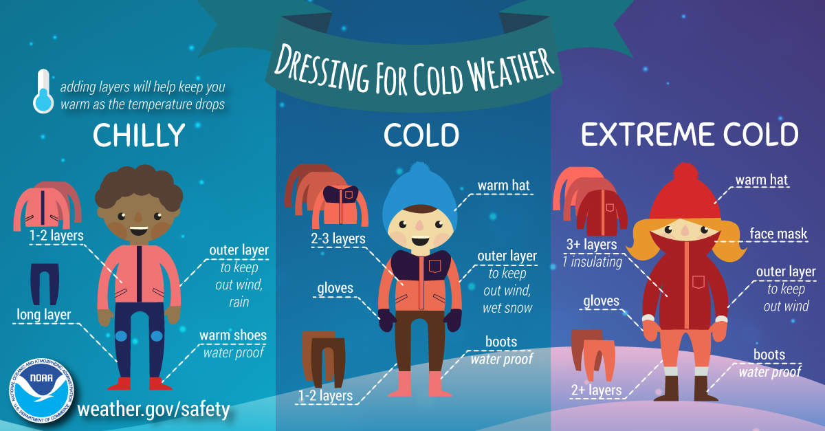
For those who must go outside, dress in layers, including a hat, face mask and gloves. Keep pets inside as much as possible and check on elderly family and neighbors. Do not use generators or grills inside, and ensure portable heaters are used correctly.
Update Jan. 23, 2:42 p.m.:
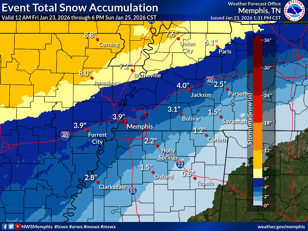
The National Weather Service has slightly altered its forecast for snow accumulations, now predicting five to eight inches of snow and sleet.
Previously:
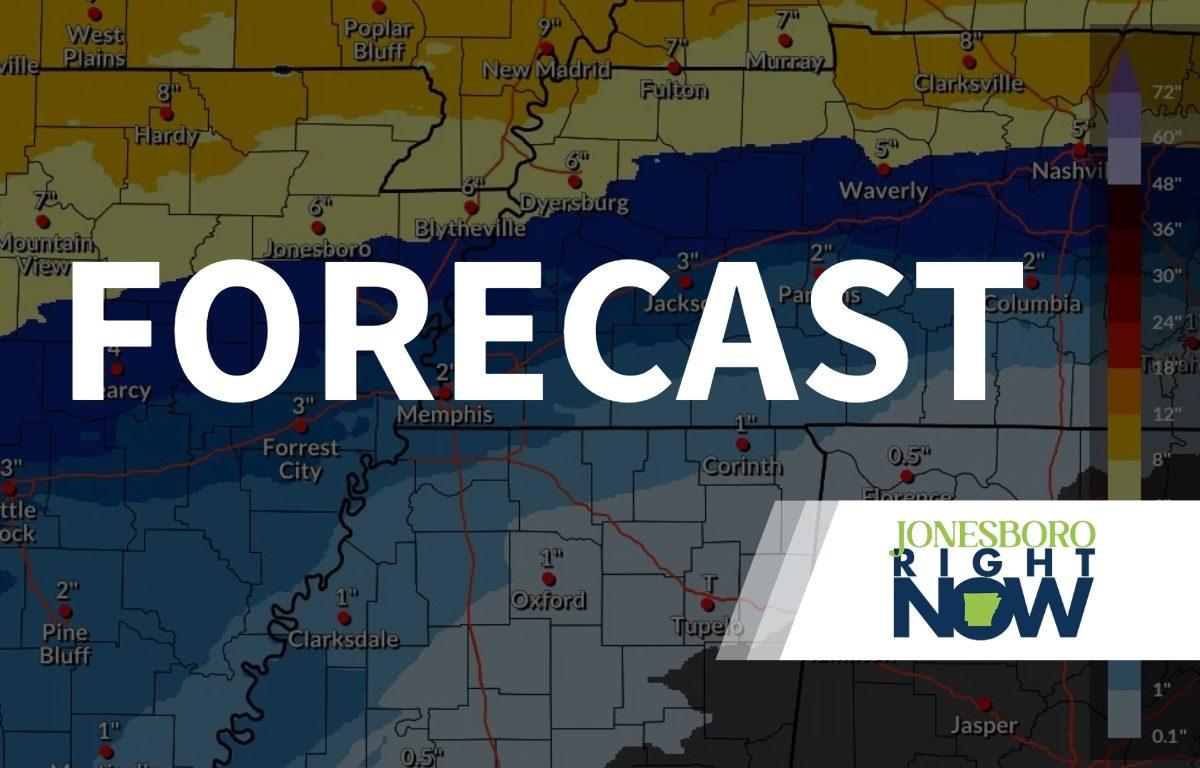
Craighead County, AR – (JonesboroRightNow.com) – Craighead County remains under the threat of severe winter weather heading into this weekend.
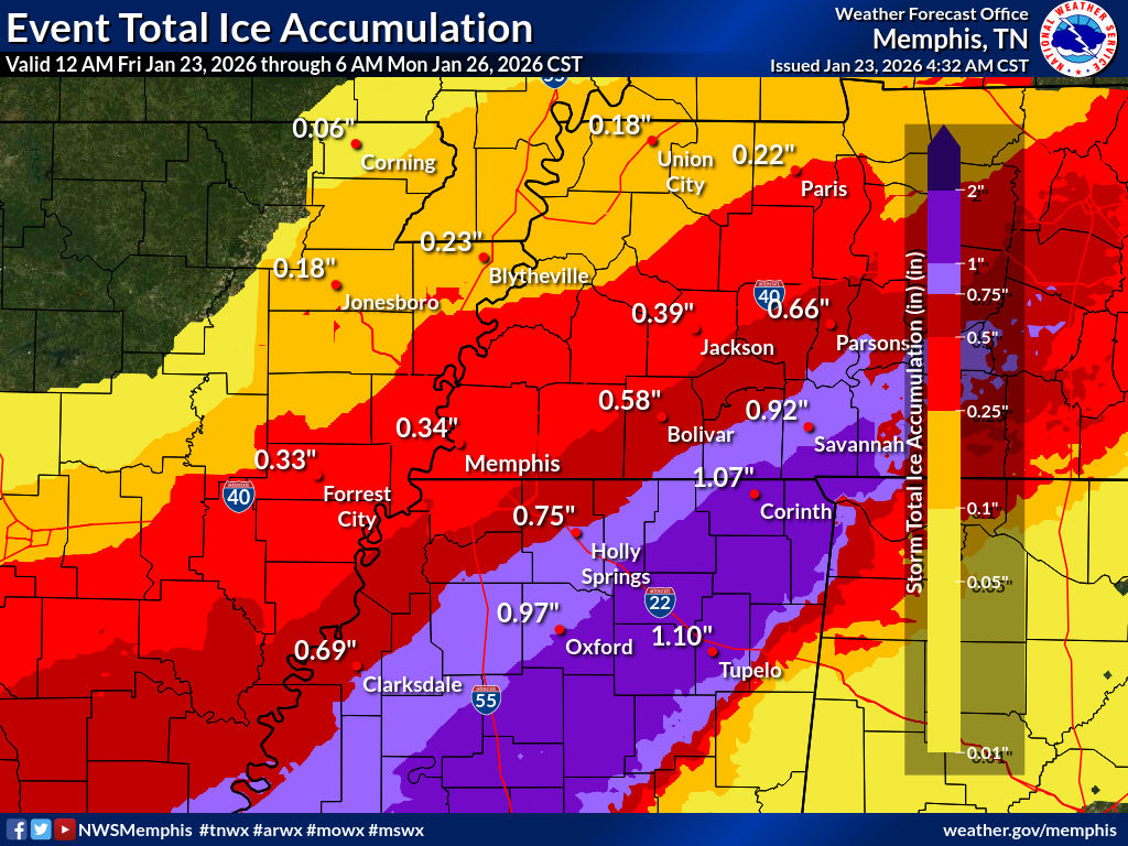
The warning goes into effect today at 6 p.m. and remains in effect until Sunday at 6 p.m. The National Weather Service is forecasting heavy mixed winter precipitation, with five to eight inches of snow and sleet expected. Ice accumulations are estimated to be 2/10ths of an inch, and wind gusts as high as 35 mph.
In addition, Craighead County is under a cold weather advisory from 6 p.m. today to 6 p.m. Sunday. The NWS said “very cold” wind chills from below 10°F to 10°F above are expected.
| WEATHER UPDATES: Click here for seven-day and hour-by-hour Jonesboro weather forecasts
“The cold wind chills as low as 10 below zero could result in hypothermia if precautions are not taken. Use caution while traveling outside. Wear appropriate clothing, a hat, and gloves,” the NWS said.
Jonesboro Forecast:
- Friday: Mostly cloudy, with a high near 32°F. Breezy, with a north-northeast wind around 20 mph, with gusts as high as 35 mph.
- Friday Night: Snow before 5 a.m., then snow, possibly mixed with sleet. Low around 11°F. Wind chill values as low as -5°F. Blustery, with a northeast wind around 20 mph, with gusts as high as 30 mph. Chance of precipitation is 90%. New snow and sleet accumulation of around an inch is possible.
- Saturday: Snow and sleet before 3 p.m., then sleet, possibly mixed with snow and freezing rain. High near 16. Wind chill values as low as -7°F. Blustery, with a north-northeast wind 15 to 20 mph, with gusts as high as 30 mph. Chance of precipitation is 100%. Little or no ice accumulation expected. New snow and sleet accumulation of one to three inches possible.
- Saturday Night: Sleet, possibly mixed with snow and freezing rain before 9 p.m., then freezing rain and sleet between 9 p.m. and 3 a.m., then snow, freezing rain, and sleet after 3 a.m. Low around 14°F. Wind chill values as low as zero. North northeast wind around 15 mph. Chance of precipitation is 100%. Little or no ice accumulation expected. New snow and sleet accumulation of less than one inch possible.
- Sunday: Snow, freezing rain, and sleet before 9 a.m., then snow, possibly mixed with sleet between 9 a.m. and noon, then a chance of snow after noon. High near 18°F. North-northwest wind 10 to 15 mph. Chance of precipitation is 90%. Little or no ice accumulation expected. New snow and sleet accumulation of one to two inches possible.
- Sunday Night: Partly cloudy, with a low around 2°F. Northwest wind 5 to 10 mph.
- Monday: Sunny and cold, with a high near 18°F. Northwest wind around 5 mph becoming west southwest in the afternoon.
- Monday Night: Mostly clear, with a low around 3°F. South-southwest wind around 5 mph.
- Tuesday: Sunny, with a high near 29°F.
- Tuesday Night: Mostly cloudy, with a low around 16°F.
- Wednesday: Partly sunny, with a high near 30°F.
- Wednesday Night: Partly cloudy, with a low around 9°F.
- Thursday: Mostly sunny, with a high near 22°F.