


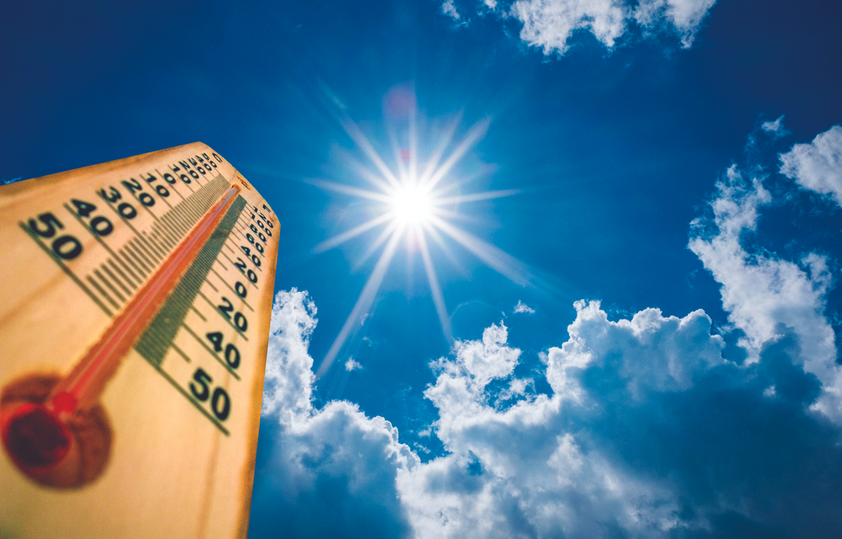

Jonesboro, AR – Jonesboro Right Now – September is supposed to be bringing Northeast Arkansas its first hints of fall. Instead, the region is in the middle of an extraordinary stretch of heat and dry weather, and the latest National Weather Service briefing suggests the pattern isn’t ready to break.
Jonesboro has already set or tied three daily high-temperature records in the past several days.
The temperature reached 102 degrees Tuesday, breaking the previous record of 100 set in 1919. Wednesday’s high of 101 broke the previous record of 100 set in 1921. And Sunday’s high of 100 degrees tied the record for the date, set in 1911 and 1939.
And despite the calendar, there isn’t an immediate transition to fall.
| ADD US ON GOOGLE NEWS: Click here to see more local news from Jonesboro Right Now
The National Weather Service says an upper-level ridge of high pressure will remain over some portion of the region well into next week, helping keep temperatures well above normal. The ridge is also suppressing rainfall, with the latest seven-day outlook showing little meaningful rain for much of the state.
For Northeast Arkansas, the forecast calls for more upper 90s and possibly 100-degree temperatures through the weekend, with cooler air finally arriving early next week. Overnight lows are expected to remain in the 70s through Monday before temperatures in the 60s become more likely. Even then, the National Weather Service says temperatures will continue to run above seasonal averages.
That means fall officially arrives Tuesday, Sept. 22, but the weather may not immediately cooperate.
The Drought is Becoming a Bigger Part of the Story
The heat is only half of the problem.
The latest U.S. Drought Monitor shows little change from the previous week, with much of Arkansas remaining in severe to extreme drought.
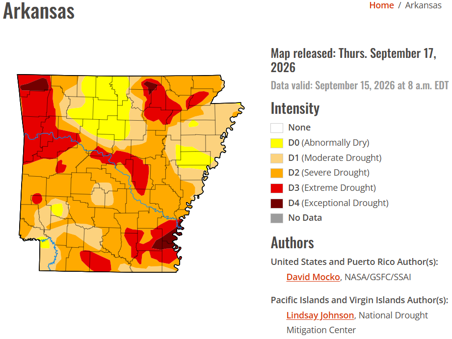
The National Weather Service says the scattered afternoon showers and thunderstorms that develop over the next several days are unlikely to make much of a dent in the overall dry conditions.
And there isn’t a major soaking rain event currently showing up with any confidence.
Some longer-range forecast models are indicating a front could move through early next week and bring better rain chances. But the National Weather Service specifically cautions that confidence is low that the front will actually produce significant rainfall.
The longer-term outlook isn’t especially encouraging, either.
The Climate Prediction Center’s seasonal drought outlook calls for drought to continue across Arkansas through the end of the year, although some improvement is expected.
The Dry Conditions are Increasing Fire Danger
The combination of heat, drought and extremely dry vegetation is creating another concern.
The National Weather Service says 10-hour and 100-hour fuel moisture levels remain very low across Arkansas, meaning that any fire that starts has plenty of dry vegetation available to burn.
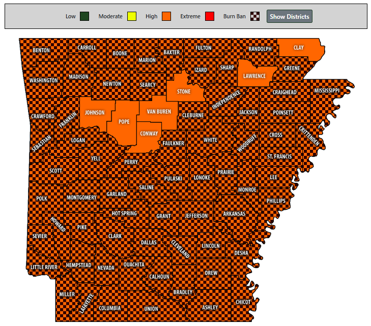
According to the Arkansas Department of Agriculture, only seven counties in Arkansas are not under a burn ban as of Sept. 17, with Lawrence and Clay being the only counties in Northeast Arkansas not impacted despite having a high risk of wildfires.
Drier air moving into the state this weekend is expected to lower afternoon humidity into the 20th to 30th percentile, which could lead to more aggressive fire behavior given the current fuel conditions.
The Big Question: When Will it Finally Feel Like Fall?
There is at least some hope on the horizon.
The National Weather Service’s current forecast shows cooler air arriving early next week, with Northeast Arkansas temperatures eventually dropping into the 80s rather than the upper 90s and 100s.
But this isn’t currently shaping up to be a dramatic flip from summer to fall.
The weather service says some relief from the heat is possible early next week, while also emphasizing that temperatures are expected to remain above average.
So, with fall arriving next Tuesday, Northeast Arkansas finds itself in an unusual position: the calendar says autumn, but the atmosphere is still behaving like the middle of summer.
And after multiple 100-degree days, record-setting heat and worsening drought, the biggest question isn’t necessarily when the temperature finally drops; it’s when we finally get enough rain to break the dry pattern.
The National Weather Service says another prolonged-heat briefing could be needed Monday if conditions warrant.
| DAILY BRIEF: Sign up for the Jonesboro Right Now Daily Brief Newsletter