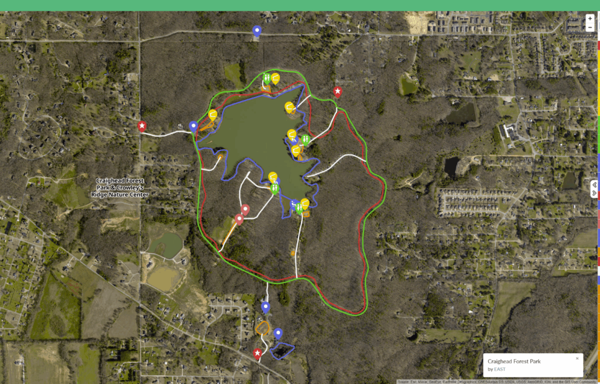

Jonesboro, AR — (JonesboroRightNow.com) — June 13, 2025 — For those who often go out to Craighead Forest Park for a walk, now it is easier to navigate than ever thanks to technology.
On June 10, the City of Jonesboro posted on its Facebook page that the newest trails have been added to the Craighead Forest Park’s interactive trail map.
Parks and Recreation Director Danny Kapales said the map is an easy way for them to get information out to visitors and allow them to be able to know where everything is located.
“I really enjoy looking at and being able to go and click on a certain trail out there, like, let’s just say, the Ferris wheel. You click on it, it kind of highlights it, and that’s the trail that you’re looking at specifically,” he said.
The project has been a collaborative effort, with students from the Education Accelerated by Service and Technology (EAST) class at International Studies Magnet School helping out with getting the map set up. The students are also helping out the Parks and Recreation Department in adding storm shelters within the schools, according to Kapales.
“It’s not just, ‘Here’s what we’re wanting to do.’ A lot of times, it’s, ‘Hey. We may have some sort of an idea the students bring to us, and then we start working with them, and then that brainstorming session takes it down this pathway of the abilities that they have,” he said.
Kapales said mapping out the trails has been a long-term process, with changing technologies making it easier for the department to quickly map new trails into the system and keep up with them.
The interactive trail map is something that Kapales said was necessary, given the times, as people are more likely to pull out their phones to look up where they’re at than look at a paper map or even a map display along a trail.
“We’re not having to make sure that we have a printout or we have it on a sign. You look at it one day, that trail is not on the app. The next day, that trail’s on the app,” he said. “Having it interactive has been such a game changer when it comes to trail systems, not only just trail systems within the park, but also trail systems throughout the city.”
Kapales said that additions like the map and the recently installed trail lights make the park more accessible for users and allow them to traverse it in the ways they want.
“You feel a little bit safer exploring the park, because now you know that when you get on that trail, you’ll be able to find your way through the trail,” he said.
As for the future of the map, Kapales described it as “a living map” and new things will be added as they continue to connect the trail system.
“When we see different areas that need maybe a new playground or maybe updating the splash pad, those are things that we’re evaluating, maybe updating pavilions out there while we’re in the process, as we continue to do that,” he said.
If you are in Craighead Forest Park and want to access the map, Kapales said there are QR codes at any of the posts along the trails that people can scan and bring up. You can also find the map by clicking here.