
Jonesboro, AR – (JonesboroRightNow.com) – April 4, 2025 – Craighead County residents woke up Friday to the possibility of more severe weather and flooding rains.
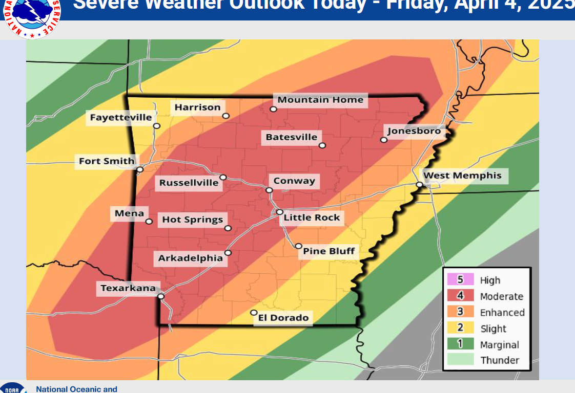
The National Weather Service Storm Prediction Center has put Northeast Arkansas in a level 4 out of 5 moderate risk area for severe weather today. A cold front that moved through the area after the storms Wednesday night will move back to the North as a warm front today. Temperatures will rise from the 50s this morning to the 70s and 80s by this afternoon putting the area at a higher risk for severe thunderstorms with damaging winds, large hail and the possibility of tornadoes.
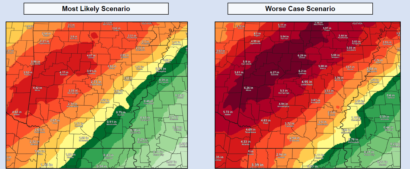
In addition, a PDS (Particularly Dangerous Situation) Flood Watch remains in effect through late Saturday night for additional flooding rains expected across the area. As of 7am this morning 2.92 inches of rain had fallen this week at the Jonesboro Municipal Airport, the location of the FAA automated weather observation station. An addition 3 to 5 inches is likely across the area, which would bring the week’s total rainfall to 6 to 8 inches. Higher amounts of rain have been recorded North of the area across South Missouri, and South of the area along the Interstate 40 corridor.
Residents are urged to stay weather aware through the day today, tonight and Saturday.
Jonesboro Media Group radio stations 104.9 The Fox, 100.5 The Eagle and Mix 106.3 will broadcast severe weather information as necessary. The KAIT “K8 Storm Team” will broadcast as necessary. Weather information is also available on the NOAA Weather Radio transmitter at 162.55 mhz.