
Jonesboro, AR – JonesboroRightNow.com – When severe weather strikes Northeast Arkansas, knowing exactly where to go can save lives. A group of Jonesboro students is making sure that finding a safe spot is not a hassle.
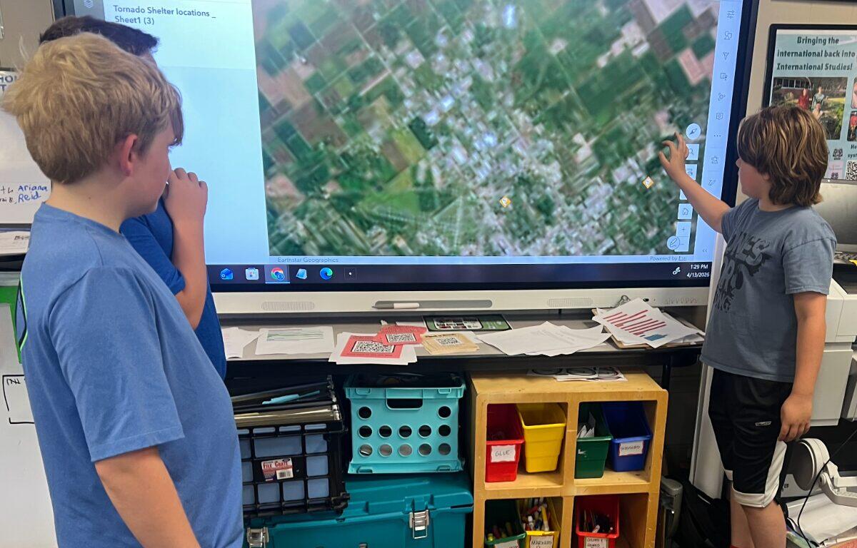
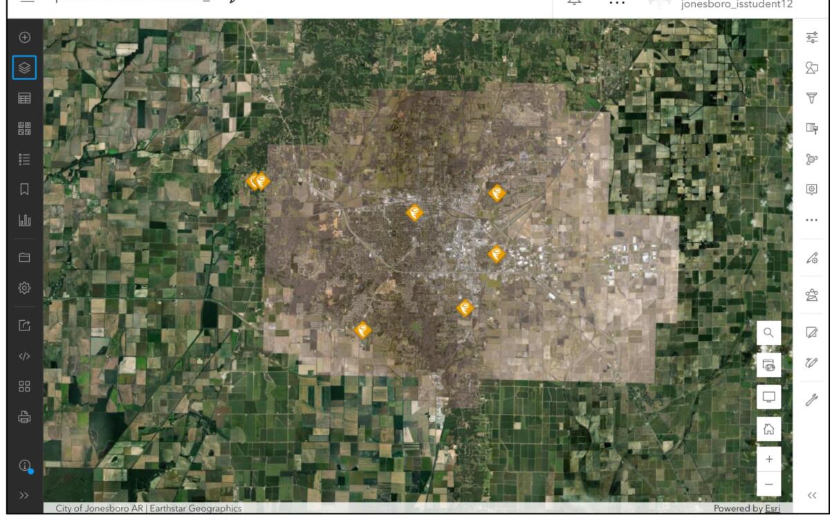
Warren McBride, Asher Homard, and Ben Heller are students in the EAST program at the International Studies Magnet School (ISMS), and they have been working on an interactive map containing locations of all the tornado shelters in the city.
| ADD US ON GOOGLE NEWS: Click here to see more local news from Jonesboro Right Now
Residents will be able to click a spot where the shelter is located to get all the information they need, and they’ll be able to see how long it will take to get there, just like a traditional map app on a phone. The goal of the project is to ensure that vital information is highly visible and easily accessible to the community. That way, when the threat of a tornado comes, people do not have to think twice about where to go.
The Origin & Process
The initiative was born out of a desire to solve a real-world problem in Craighead County. At the beginning of the school year, the students brainstormed projects focused on natural disasters and emergency preparedness.
“It is important because the city has not made a map of public tornado shelters in Jonesboro, and also because people need to know where the public tornado shelters are when there is a tornado, so they can get there quickly,” McBride said.
Heller said his motivation was simple. “I like to help the community. And I was like, ‘That would be a fun and helpful way,’” Heller said.
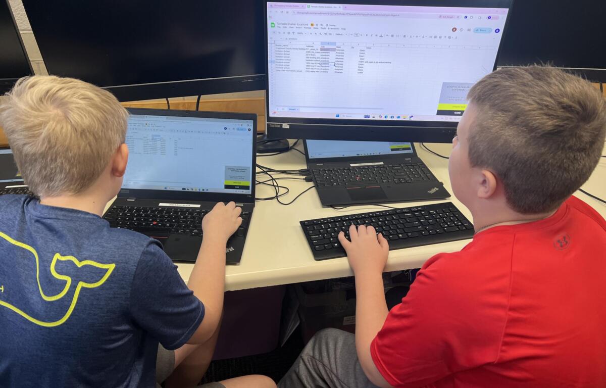
Building a reliable public resource requires research and the right technology. The students divided the workload, with some handling data entry and others designing the presentations. They began by finding a past city social media post that listed nine shelters. EAST facilitator Carman Owens said the information was entered into Google Sheets, then exported and imported into ArcGIS, which helped create the map with all the points and necessary information for residents.
McBride noted that the most challenging aspect was simply getting the addresses correct, as several zip codes in their source data were incorrect. To troubleshoot, the students used ChatGPT to identify and fix broken zip codes in their database.
The mapping process also shed light on gaps in what is and isn’t known about the shelters. McBride noted it was surprising the city hadn’t mapped them out already, theorizing it might be due to capacity concerns. He explained a potential fear that if 500 people showed up and the shelter only allowed 400, there would be no way to tell them.”
The Expert Consultation
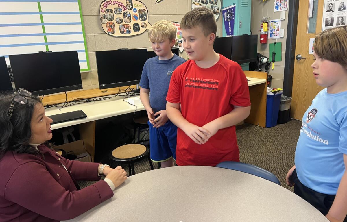
To ensure the map met community needs, students sought feedback from local professionals. Recently, the team presented their ongoing work to K8 News Chief Meteorologist Ryan Vaughan to get an industry perspective.
Vaughan advised the team to explore the rules regarding pets, noting that many people will choose to stay in unsafe homes if they cannot bring their animals. This advice immediately shifted the students’ focus.
Homard pointed out that without pet-friendly options, residents might stay home during a tornado, putting them at risk. As a result, the students are updating the map’s interactive pop-ups to indicate whether pets are allowed.
Helping the Community
The project goes beyond simple geography; it is a testament to the core philosophy of the EAST initiative.
“Our whole focus is to do projects to help our school or help our community, either solve a problem or make an improvement somehow,” Owens said.
For the students, the gravity of their work is becoming clear. McBride reflected on the reality of the project, noting they didn’t fully realize how much they were helping until they considered that they live in an area that “consistently has three tornadoes every year”.
What makes this project even more remarkable is the age of the team executing it.
“These kids are in fourth grade, and they’re doing something that’s going to impact adults and potentially lots of people,” Owens said. “I mean, that’s pretty amazing to be able to accomplish that at 10”.
Looking Ahead
As the mapping project nears its final stages, the focus shifts to getting this resource into the hands of Jonesboro residents.
The final map is a digital link accessible on phones and computers, complete with a QR code. The team’s next major step is presenting the project to the city for official approval, with hopes of getting the map on the city’s website and social media.
The students have an ambitious roadmap for the project’s next phases. McBride noted the team plans to create a “360 tour” of every mapped shelter so residents can see the interior ahead of time. Homard hopes that showing pictures of the shelters will help people decide whether it’s the right fit for them.
The team is also working on mapping parking spots at each location to help people know where to go to get into the shelters more quickly. To make the physical shelters as visible as the digital map, the students plan to design and install bright yellow signs at each location. These signs will feature a QR code so residents can quickly locate an alternative shelter if the first one is full.
“I hope that people will continue working on our map and improving it to where it’s so good that, you know, it’s really going to be perfect, and we won’t have this problem anymore,” McBride said.
| DAILY BRIEF: Sign up for the Jonesboro Right Now Daily Brief Newsletter