

Craighead County, AR – (JonesboroRightNow.com) – As drivers continue returning to the roads in the aftermath of this weekend’s winter storm, the National Weather Service (NWS) is warning motorists of potential hazards.
In a special weather statement issued Wednesday morning, the NWS warned drivers of lingering black ice and freezing fog. Black ice is a transparent coating of ice that forms on roads, which is nearly invisible to drivers and very slick.
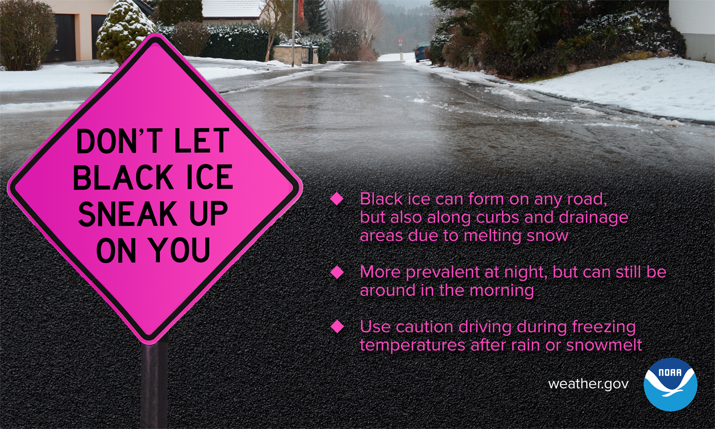
“Roads across the region remain covered in snow, sleet and solid ice. Travel on secondary roads is virtually impossible in many locations,” the NWS said. “Even where main thoroughfares have been treated, motorists should exercise extreme caution. Any slush or partial melting that occurred during the day will rapidly refreeze and temperatures drop below freezing at night. This will result in the formation of widespread ‘black ice.'”
| READ MORE: Crews working to clear Craighead County roads after winter weather
The NWS asked drivers to avoid non-essential travel. Those who must drive should keep a flashlight, food, and water in their vehicles.
If driving out on the roads, increase the distance between other drivers, slow down, avoid sudden turns, speeding up or slowing down, and be extra cautious on bridges and intersections.
To check the latest road conditions, check IDriveArkansas.com. To activate the winter weather layer on the IDriveArkansas website or app, click the snowflake icon.
Jonesboro Forecast:
- Wednesday: Sunny, with a high near 31°F. Calm wind becoming southwest around 5 mph.
- Wednesday Night: Areas of dense fog between 4 a.m. and 5 a.m. Widespread dense freezing fog after 5 a.m. Otherwise, mostly cloudy, with a low around 19°F. South wind around 5 mph becoming calm.
- Thursday: Widespread dense freezing fog before 7 a.m. Mostly cloudy, with a high near 35°F. Calm wind becoming east-northeast around 5 mph in the morning.
- Thursday Night: A slight chance of rain and snow before 9 p.m., then a slight chance of snow between 9 p.m. and midnight. Mostly cloudy, with a low around 19°F. North-northeast wind 5 to 10 mph. Chance of precipitation is 20%.
- Friday: Mostly sunny, with a high near 26°F. North wind around 10 mph.
- Friday Night: Partly cloudy, with a low around 9°F. North-northeast wind 5 to 10 mph.
- Saturday: Sunny, with a high near 21°F. North-northwest wind 5 to 10 mph.
- Saturday Night: Mostly clear, with a low around 8°F. Northwest wind around 5 mph becoming calm.
- Sunday: Mostly sunny, with a high near 28°F.
- Sunday Night: Partly cloudy, with a low around 21°F.
- Monday: Mostly sunny, with a high near 39°F.
- Monday Night: Partly cloudy, with a low around 24°F.
- Tuesday: A 20% chance of rain. Partly sunny, with a high near 41°F.